Handy Laser
3D laser measurement system for indoor/underground facilities/woodland/under elevated bridges.
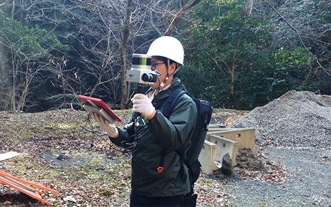
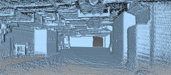
This real-time handy scanning survey uses a “mobile 3D laser scanning technology” that acquires highly accurate point cloud data without using GNSS. Just by turning on a small-sized system and walking, it can immediately acquire point cloud data with high precision. Whether used indoors or outdoors, 3D terrain data can be acquired quickly even in case of emergency.
Features
For scanning indoors, this is a compact equipment device that does not require a place for installation. Therefore, high accuracy measurement is possible even underground, and seamless point clouds can be obtained even while moving. It can be used for reproducing images of facilities and “drawing” for designing new equipment, and checking interference when carried in. As a support of topography survey/tree survey/disaster recovery design, it can be used to draw contour lines and measure the position of the trees and the thickness of the tree trunks based on the ground data of laser point clouds.