
Spatial Information Processing
We provide capturing spatial/terrain information, surveying, analyzing and drawing data.
In the spatial information processing field, we mainly use ICT equipment to acquire spatial information at all scenes such as sky, land and underground. As a result of these survey methods, we have been able to survey in forests and buildings quickly with very high accuracy. We also provide software that stores existing data, results obtained from ICT equipment, and GIS data through the system development aimed at uniform control of managements and operations.
Services
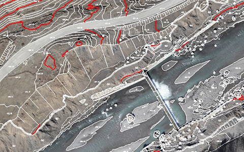
Aerial Photogrammetry
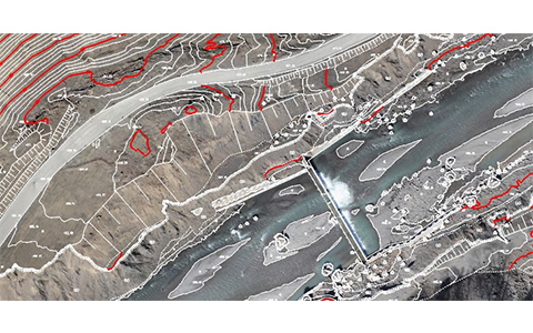
Aerial photogrammetry has technologies and equipment to create numerical topographic maps (level 500 to 5,000) according to the needs of the client. And we have many actual achievements in aerial photogrammetry. The created topographic maps are utilized in a wide range of fields such as survey, planning, design, construction, maintenance and management. By combining with ICT equipment, we also contribute to the renewal of urban facilities and mitigation of natural disasters by creating highly accurate maps.
Records Creation
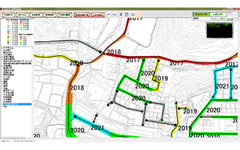
We create various facilities and equipment records such as road attachments, slopes, retaining walls, underground buried parts as well as road records, bridge/tunnel records. We also make new map and modification with MMS for the road records of local municipalities. Especially for the facility records on highway, we create the facility records with the photos acquired by our MMS.
Pavement Inspection
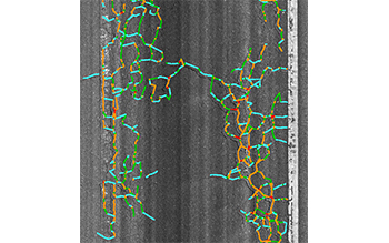
We survey cracks, ruts and flatness of pavement and number of patching parts using the survey instrument that passed the performance verification test of automatic pavement surveying equipment (implemented by The Public Works Research Center) to grasp the current condition of the road. We conduct surveys using a MMS and it makes the determination result displayable on a map. With our LCMS-equipped MMS introduced in 2017, we can distinguish cracks, ruts and IRI by automatic processing.
Analysis Processing for Point Clouds
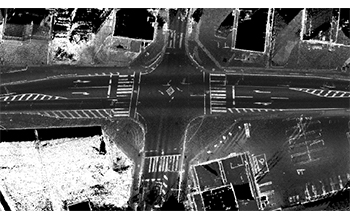
We introduced our first MMS in 2011. As of 2018, we operate various LIDAR systems such as fixed type, mobile type, and SLAM type. We generate point cloud data according to each system and process to utilize the point cloud data.
GIS/Database
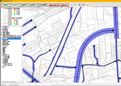
If the drawing is paper-based, we perform scanning, positioning coordinates and tracing various data to make it digitalized. By entering and sorting out the attribute data and files for each drawing, we organize them as geospatial information data. By importing data such as aerial photographs, it is also possible to overlay various data and analyze them. We also enter and organize the database to utilize the data statistically.
System Development
In the stock cycle, we develop a maintenance planning system for maintenance management including inspection records to repair plan and budget coordination. We also correspond to various facilities such as roads, sewage, water supply and harbors. We also handle charging with the counter service system to reduce the load of the customers. And we realize detailed functionality and operability by customizing according to customer’s need. We also create viewers of 3D data and 3D analysis processing programs for utilizing ICT equipment.
