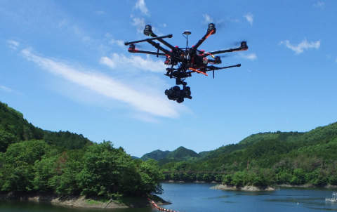
UAV Photography
Photographing with UAV and 3D data restoration data generation system.
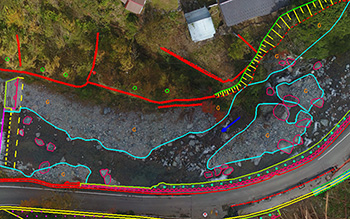
We use a technique called “SfM(Structure from Motion)” that creates 3D restoration data from multiple pictures. 3D restoration data (point clouds/models) can be acquired only by surveying several control points at the site. It is also possible to cut out a picture from a motion video and generate 3D restoration data. It can be applied to various objects such as disaster sites in rivers/mountainous areas, slopes, dams, bridges, buildings, etc.
Features
We can efficiently perform site work by utilizing a UAV enabled photographing for 60 minutes. Since it shoots with a camera with a maximum of 50 million pixels, it is possible to generate 3D restoration data with less than 5 cm accuracy. Based on ortho-photographs and 3D restoration data, it can also be used to create topographic maps and to extract cracks in a dam embankment. It can also mount an infrared camera, so we can check the temperature difference from the pictures.